
Walk a Geneva Street Record
A reliable Geneva street directory search labels each fact by source. Ownership comes from the Kane County tax card and recorded instruments. A voter result confirms only the status and districts returned for a known surname and location. A directory entry is tied to its publication year. This distinction matters because an owner can receive mail elsewhere, a recorded buyer may not occupy the parcel, and a directory can omit members of a household.
- Enter the house number, street name, street type, and Geneva in the Kane County Property Tax Inquiry. Save the PIN, site address, owner block, tax year, and legal description.
- Open KaneGIS4 and select the parcel. Use its map context to move along the street, then return each PIN to DevNet for the official tax-card fields.
- Test a known surname in the Kane voter search with either the house number or street name. Record only the status, precinct, polling place, districts, and ballot information shown.
- Search the Recorder by PIN, address, owner name, and legal description. Read each grantor, grantee, instrument type, and filing date before linking a deed to the parcel.
- For an older occupant question, use the regional directory and newspaper collections. Keep the directory year and address spelling with every name.
The flow is address to PIN, PIN to parcel card, parcel to deed, then a known name to a voter or historical source. That sequence reduces false matches and keeps current street work separate from the backward house trail.
Geneva Street Search Fields
DevNet is the strongest first stop for a Geneva by-address search because it accepts a partial set of parcel facts and returns a card with both land and tax context. At least one ordinary field is required. Owner names should follow the tax bill, and parcel numbers may be entered with or without dashes. The advanced form adds sale, district, class, subdivision, and tax-year controls. It does not display a ZIP field, so a ZIP-wide claim should not be inferred from the portal.
| DevNet field | Input | Use on a street |
|---|---|---|
| Parcel Number | PIN, dashed or undashed | Returns one known parcel |
| Owner Name | Name as printed on tax bill | Checks title-holder matches |
| House Number | Numeric address | Narrows a repeated street name |
| Street Name and Type | Name plus ST, RD, AVE, or other type | Builds an address search |
| City | Geneva | Separates the municipal label |
| Advanced filters | Sale dates, township, district, class, subdivision, tax years | Tests a street segment or earlier tax year |
A result may show site address, owner and mailing address, tax year, class, township, acres, legal description, assessments, exemptions, taxing bodies, and payment panels. Select the current tax year for current assessment data, and never use the working card in place of a tax bill, survey, or deed.
Geneva Address Labels Differ
A local parcel card can carry three place labels at once. The researched sample has a Geneva site address, a St. Charles mailing city, and St. Charles as its tax township. That is not an error. The site, or situs, address marks the parcel’s physical location. The mailing block tells where tax mail goes. Township and city fields describe other government geography.
- Parcel
- A mapped unit of land identified by a Kane County PIN.
- Situs address
- The street address assigned to the physical parcel, distinct from the owner’s mailing address.
- Plat
- A recorded map that fixes lots, blocks, subdivisions, or boundary details.
- Criss-cross directory
- A directory arranged by address or street rather than only by a person’s name. Exact Geneva reverse-directory years must be checked in the volume.
The legal description is often the most stable bridge. It can preserve the lot and subdivision when a street string changes or an owner uses a different mailing city. A survey, not KaneGIS4, controls a boundary question.
Geneva Records Organized by Address
No single record set is the Geneva street directory. The useful sources overlap, but each proves a narrower point. The parcel card identifies the assessed owner and tax geography. GIS provides map context. Recorder entries document filed instruments. City files may identify an applicant or contractor, and voter lookup results answer a limited election question.
| Address source | Keeper | Evidence supplied | Available route |
|---|---|---|---|
| Parcel tax card | Kane Supervisor of Assessments | Owner, site, mailing, PIN, class, legal description, tax years | Free DevNet search or Building C counter |
| Parcel map | Kane County GIS | Parcel shape, adjoining land, districts, map layers | Free KaneGIS4 viewer; data request when needed |
| Recorded instrument | Kane County Recorder | Grantor, grantee, filing date, type, PIN, lot and legal description | Free web index, office computers, books, or official-copy request |
| Voter result | Kane County Clerk Elections | Status, precinct, polling place, districts, sample ballot | Known surname plus house number or street |
| Permit or code file | Geneva Building and Zoning or Code Compliance | Project, applicant, inspection, notice, or hearing context | Department request or focused city FOIA |
| Historical directory | GPLD and Batavia Local History Room | Dated name, address, phone, or business entry when printed | Library databases, reference help, or in-library volumes |
Cross-source labels prevent a common error. “Owner,” “mail recipient,” “applicant,” and “directory occupant” are not synonyms. Note the record date beside every name.
Map Geneva Parcels by Street
KaneGIS4 is the visual part of a street-by-street search. Search or pan to the target address, select its parcel, note the PIN, then click adjacent shapes and send those identifiers back to DevNet. The GIS FAQ warns that its geometry is not a survey. Its value is orientation: parcel order, district layers, road context, and the relationship between a street label and tax parcels.
Geneva’s official Street Index Map adds municipal context when a road name or segment is hard to place. For historic addresses, also check plats and legal descriptions. No verified citywide street-renumbering project or year was found, so a changed house number should never be assigned to a particular event without direct map or deed proof.
Deeds Along a Geneva Street
The Kane County Land Records Search offers quick name, document-number, and PIN searches plus advanced grantor, grantee, subdivision, block, lot, section, township, range, document type, remarks, address, ZIP, and date controls. Ordinary searching is free and needs no account. An account is used for Property Watch. Online prints are unofficial, while official or certified copies come from the Recorder.
Address indexing is incomplete. If a Geneva street directory search fails, try the PIN without dashes, the subdivision and lot, the legal description, a directional variant, or an owner surname. Pre-1975 research begins with entry books and book/page paths rather than a promise that every old deed is searchable by address. The office states that its permanent land archive dates to 1837, but the exact first year in the online index was not verified.
Geneva Permits by Street Address
Geneva Building and Zoning handles permits for work such as decks, driveways, electrical changes, fences, garages, remodeling, roofs, sheds, and solar projects. The submission portal is authenticated and did not expose an anonymous address archive. A historical permit search therefore moves to the department or to a focused Illinois Freedom of Information Act request that gives the street address, PIN, permit type, and date range.
The Geneva e-permit portal shows the active online application, upload, and payment channel.
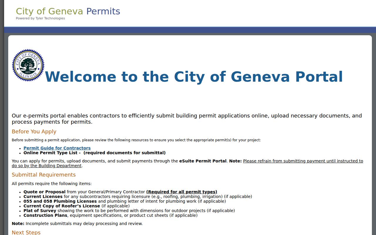
The screen documents the submission route, not a public list of residents. A permit may name an applicant or contractor rather than the assessed owner or occupant.
Geneva Street Concern Records
Code Compliance uses complaint-driven and routine inspections, written notices, monthly administrative hearings, and final orders where applicable. No public address-keyed case index was located. Request a specific address and date span, and expect private or active portions to be withheld when an exemption applies.
The city’s Report a Concern route is an intake and status channel for city issues.
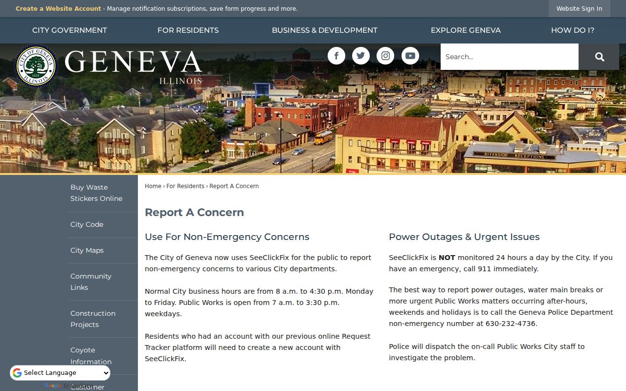
This screen helps route a current concern. It does not prove that the complaint target owns or lives at the address, and it does not replace a request for the retained public file.
Check Geneva Voter Street Clues
The Kane voter lookup accepts Last Name plus either House No. or Street Name Only. The street box takes the name alone, such as Maple or Randall, without the house number. Results can show registration status, precinct, polling place, voting districts, and a sample ballot. The tool does not expose an anonymous full block roster, date of birth, phone, email, or party field.
Use it only to test a person and address already known from another lawful source. A voter result does not establish every member of a household, and a tax owner does not have to be registered at that parcel. State voter-file rules redact sensitive fields and restrict reuse.
Historic Geneva Streets in Print
Batavia Public Library’s Local History Room lists intermittent Tri-City directories from 1910 through 1947, telephone books from 1934 through 1956, and Polk Fox Valley runs from 1950 through 2018 with gaps. Those volumes are mostly in-library. Their titles do not guarantee a reverse street section, so inspect the contents and abbreviation key before claiming an address-to-name match.
Geneva Public Library adds searchable Geneva Republican coverage from 1878 through 2016 and licensed genealogy databases. A dated directory result may be checked against a newspaper notice, but the complete historical shelf belongs in the Geneva city directories account. For by-street work, record only the year, printed address, name, page, and how the volume arranged entries.
Geneva Street History Needs Maps
Geneva’s 1838 survey deliberately laid out wide streets for trade. The railroad arrived in the 1850s, Lincoln Highway followed in 1913, and State Street paving came in 1916. Those are useful map and directory eras, not proof that a specific address changed then. Annexation plats can add section, township, range, and boundary language when today’s municipal label does not fit an old deed.
The 2026 Historic Designations StoryMap adds property photographs, ratings, design notes, and context drawn from the 1999 survey, a 2016 update, and later city research. It can describe a structure without naming a resident. This makes it a strong companion to the street directory when the question concerns what stood on a lot, not merely who owned it.
Limits of Geneva Street Records
A street directory cannot show every person in a home. Parcel records name an assessed owner, not all occupants. Deeds document instruments, not day-to-day presence. The public voter tool requires a known surname and location and omits protected details. Utility customer information and library patron records are not public resident lists. Recent vital certificates, restricted court files, and protected addresses have their own access rules.
For a current whole-street question, label only what the source says and avoid turning a map into a household roster. For a historical address trail, move to the Geneva past residents workflow, where deeds, directories, census schedules, maps, and permits are aligned by year.
Lawful use. Geneva address records support family history, property research, and civic inquiry. Never use them to stalk, harass, threaten, or expose a protected person.